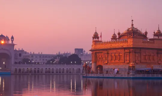
Landmarks & Legacies - Latin Wonders of the world

The Society’s archives comprise over 7,000 items specifically relating to the historical geography of South America, dating from the 17th century to the present day. Highlights include a series of striking watercolour paintings attributed to Joseph Brown, a British trader, who lived in Colombia between 1826 and 1841, a hand-drawn map of the Rio Negro by Alfred Russel Wallace from his exploration of Brazil with Henry Walter Bates from 1848-1852, and an aneroid barometer used by Percy Fawcett during his expeditions into the interior of Brazil between 1906 and 1925.

In the footsteps: Victor Coverley-Price | In the footsteps: Clements Markham | In the footsteps: Sir William Marin Conway | In the Footsteps: Henry Walters Bates

In the footsteps of: Victor Coverley-Price

In 1932, Victor Coverley-Price was invited by the Secretary of the Royal Geographical Society to join Professor J.W. Gregory as interpreter and artist on his forthcoming expedition to Peru. Gregory, a geologist, planned to study the geology and volcanic activities in the region and worked alongside Meta McKinnon Wood, who specialized in fossil collecting, and Mariano Tarnawiecki, a mining engineer who resided in Peru. The expedition also relied heavily on the knowledge of indigenous Peruvians to aid their travel through the unknown and difficult terrain.
Their exploration began amongst the arid landscapes of the Paracas Peninsula and the Nazca Desert on the west coast. From there, they travelled east into the high Andes towards Cuzco and the Rio Urubamba. Throughout the expedition, Coverley-Price found time to document the beauty of the landscape through a series of stunning watercolours. Whilst navigating the Rio Urubamba, their canoe capsized on the powerful Pongo de Mainique rapids and tragically, Gregory and one of the guides were swept downriver and drowned.

In the footsteps of: Clements Markam

After leaving the Royal Navy, Clements Markham travelled to Peru and set off across the Andes via Nazca to Cuzco, arriving in March 1853 after a 300-mile journey. He spent several weeks in and around Cuzco and it was at this time that he was first introduced to the cinchona plant, its cultivation and its use as a source of quinine as treatment for malaria. In 1860, he led the ‘Cinchona Mission’, along with the botanist, Richard Spruce, to collect cinchona plants and transplant them to selected sites in India for quinine production. Twenty years later Markham’s vision was realised as the cinchona plantations in India were producing 220,000 kilograms of quinine bearing bark.
Markham also spent time researching Inca history and describing the architecture and Inca ruins throughout his journey through Peru.

In the footsteps of: William Martin Conway

William Martin Conway began climbing whilst at university and was elected as a member of  the Alpine Club in 1877. In 1892 he mapped 2,000 square miles (5,180 square km) of the Karakoram Range in the Himalayas and was knighted three years later in recognition of the achievement.

In 1898 he set out on an expedition to the Bolivian Andes where he made the first recorded ascent of Mount Illimani with two Swiss guides, Antoine Maquignaz and Louis Pellissier.

Conway's expedition helped establish some of the first reliable maps of certain regions of the Bolivian Andes, and he documented his findings in his book "The Bolivian Andes: A Record of Climbing & Exploration in the Cordillera Real in the Years 1898 and 1900."

His work in the Bolivian Andes contributed significantly to both the geographical understanding of the region and the development of high-altitude mountaineering in South America. Conway's background as an art historian and his attention to detail also meant that his expedition accounts included valuable observations about the cultural and archaeological aspects of the regions he explored.

Right: ‘Swiss guides on summit of Mt. Illimani’. Photographer: Sir William Martin Conway, 1898.
Right: ‘Bolivian Andes in the neighbourhood of La Paz’ by Sir William Martin Conway, 1898.

In the footsteps: Henry Walters Bates

Henry Walter Bates was a keen entomologist, publishing his first scientific paper at the age of 18. In 1848 he began a joint expedition with Alfred Russel Wallace to the Amazon basin with the aim of collecting natural history specimens. After four years, Wallace left to explore the Malay Archipelago but Bates remained in the Amazon for a total of 11 years, covering more than 2,900km (1,800 miles) and collecting over 14,000 species, 8,000 of which were new to science.

On return from the Amazon, Bates began sorting his vast specimen collections and embarked on a major series of articles on Amazonia’s insect life, with particular attention to butterflies and beetles. The most important of these was the ‘Contributions to an Insect Fauna of the Amazon Valley. Lepidoptera: heliconidae’ which included his ideas on the geographical analysis of species distribution and his theories on insect mimicry. His theory, suggesting that insects mimic the colours and markings of other harmful or toxic, inedible insects to avoid being eaten by predators, was later named ‘Batesian mimicry’ and is recognised as an important contribution to the evolution of Darwinian ideas. In 1863, encouraged by Charles Darwin, Bates published an account of his expedition, titled ‘The Naturalist on the River Amazons’ (1863).

‘Camping on the Amazons’. Illustration from ‘Central America, the West Indies and South America’ by Henry Walter Bates, 1878
‘Interior of primaeval forests on the Amazons’. Illustration from ‘The Naturalist on the River Amazons’ by Henry Walter Bates, 1863
Scarlet-faced and Parauacú monkeys’. Illustrations from ‘A naturalist on the River Amazons’ by Henry Walter Bates, 1863
‘There is something in a tropical forest akin to the ocean in its effects on the mind. Man feels so completely his insignificance there, and the vastness of nature. A naturalist cannot help reflecting on the vegetable forces manifested on so grand a scale around him.’

The Partnership Tours

All historical images (photos, artwork, maps) ©RGS-IBG